Producir XXI, 16 de febrero 2024
Pronóstico: las lluvias se centrarán en cuyo

Instituto de Clima y Agua
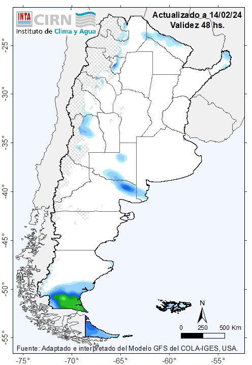
Se esperan lluvias y tormentas de variada intensidad sobre Cuyo, reg. Pampeana (oeste y sur), el NOA (oeste) y Misiones. Podrían ser intensas sobre el extremo noroeste.
LO QUE PASÓ
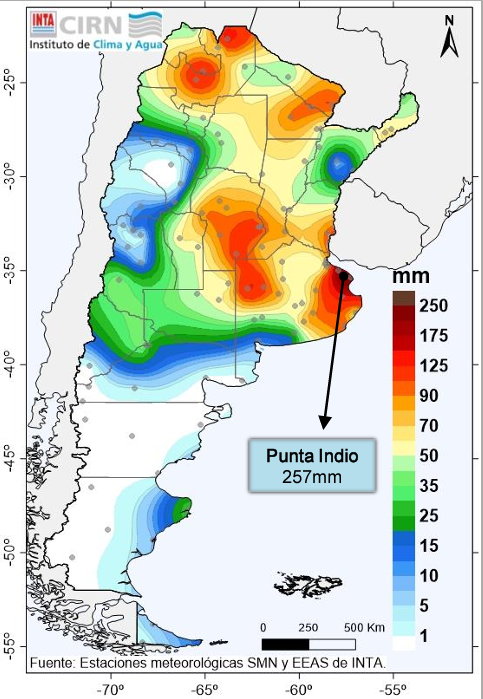
Lluvias y tormentas en distintas áreas del centro y norte del país. Se observaron áreas con acumulados semanales mayores a 50-60 mm de manera generalizada.
Temperaturas máximas absolutas superar los 38°C

LO QUE VIENE
TEMPERATURAS ELEVADAS: se podrían
registrar valores cercanos a los 40°C
en áreas del norte, centro-oeste del
país y norte patagónico.
LLUVIAS y TORMENTAS de variada
intensidad sobre Cuyo, reg.
Pampeana (oeste y sur), el NOA
(oeste) y Misiones. Podrían ser
intensas sobre el extremo noroeste.
Lluvias y lloviznas aisladas sobre
Santa Cruz (sur) y Tierra del Fuego.